
Your Infrastructure Data Has More to Tell You
The world is becoming more data-centric, and community infrastructure is no exception.
Geographic information systems (GIS) is a tool that has been around for years. The possibilities for GIS continue to evolve as more data becomes available. Asset inventories, condition assessments, risk assessments and other data collection methods give us tremendous amounts of information about the infrastructure around us. However, the greater value comes from what we do with that data.
The possibilities and applications are endless.
What If We Don’t Have All the Information We Need?
For some communities, the starting point is a lack of reliable infrastructure data.
Records may be incomplete, assets may never have been inventoried or mapped, and critical information may live only in paper plans or institutional knowledge.
The first step is establishing what you know and identifying what you don’t know.
Field data collection, asset inventories, condition assessments and GIS can help fill those gaps and build a dependable baseline for future infrastructure decisions.
It is impossible to manage something if you don’t know it exists. GIS is the perfect tool to track the location and information associated with the assets you own.
We Have Information, But Are We Using It Effectively?
Other communities and infrastructure owners face a different challenge: understanding what information they have, bringing it together and using it effectively.
Today, communities are juggling priorities to decide what needs attention, what can wait, where risk is increasing and where limited resources will make the greatest difference.
Answering those questions requires engineering expertise paired with effective use of the right information.
Unknown data and information on hand. How do we create an infrastructure asset inventory? How do we track infrastructure conditions?
Disconnected information. How do we organize infrastructure data or combine information from different departments or sources?
Aging infrastructure. How can we anticipate maintenance needs before they become larger problems?
Limited budgets. How do we prioritize infrastructure projects and determine which assets need investment first?
Uncertainty about the future. What will our infrastructure need in five, 10 or 20 years?
Difficulty communicating needs. How do we justify infrastructure investments to leadership, elected officials and communities?
Infrastructure management and data analytics can help transform those questions into more informed, defensible decisions.
The Bigger Picture of Collaboration Across Disciplines Matters
Data is a common thread connecting every infrastructure discipline. Today’s needs require proper use and integration of that data.
When a surveyor captures what exists in the field, an engineer may need that information to model a system. An asset manager may use condition information to assess risk. A planner may need to understand how today’s infrastructure will support tomorrow’s growth.
Infrastructure management and data analytics connect those perspectives through infrastructure data analysis, forecasting, visualization, dashboards and GIS. What might initially seem like disparate information can actually be brought together and turned into actionable plans, recommendations and even stories for project buy-in.
How Do Data Analytics Apply to Multiple Infrastructure Areas?
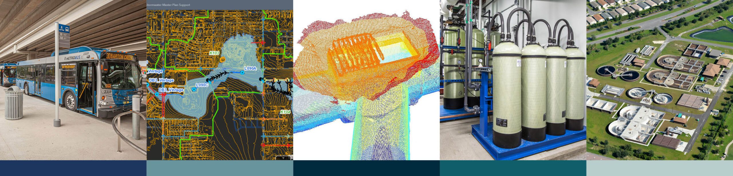 With infrastructure being as interconnected as it is, data analytics weave together all areas of the built community and its underlying systems, from transportation to water systems and more.
Applications in Water/Wastewater
Water and wastewater systems generate enormous amounts of information about assets, condition, operations and maintenance. Infrastructure management and data analytics can connect that information to infrastructure risk assessments and lifecycle planning, helping utilities move beyond asking what they own to what they should address first.
Applications in Water Resources and Stormwater
Reliable data can strengthen everything from prioritizing projects to creating watershed models. Combining GIS with inspections, condition information and engineering analysis gives communities a clearer understanding of vulnerabilities and helps move maintenance and capital planning from reactive to proactive.
Applications in Planning
Infrastructure data can also help communities look forward. Connecting existing conditions with growth, investment and other planning information gives decision-makers a stronger basis for evaluating where infrastructure needs are emerging and how today’s decisions may affect tomorrow’s communities.
Applications in Energy
Energy infrastructure depends on reliable information to understand assets, conditions and performance across complex systems. By pairing geospatial data with advanced analytics, reporting and visualization, that infrastructure data helps teams identify patterns and understand risk in order to make clearer planning and investment decisions.
The same applications of data analytics for infrastructure management extend across many other areas, including environmental, mechanical, electrical and plumbing (MEP), right of way (ROW), transportation, construction services, landscape architecture and other disciplines.
4 Examples of Data Analytics Making a Difference in Communities
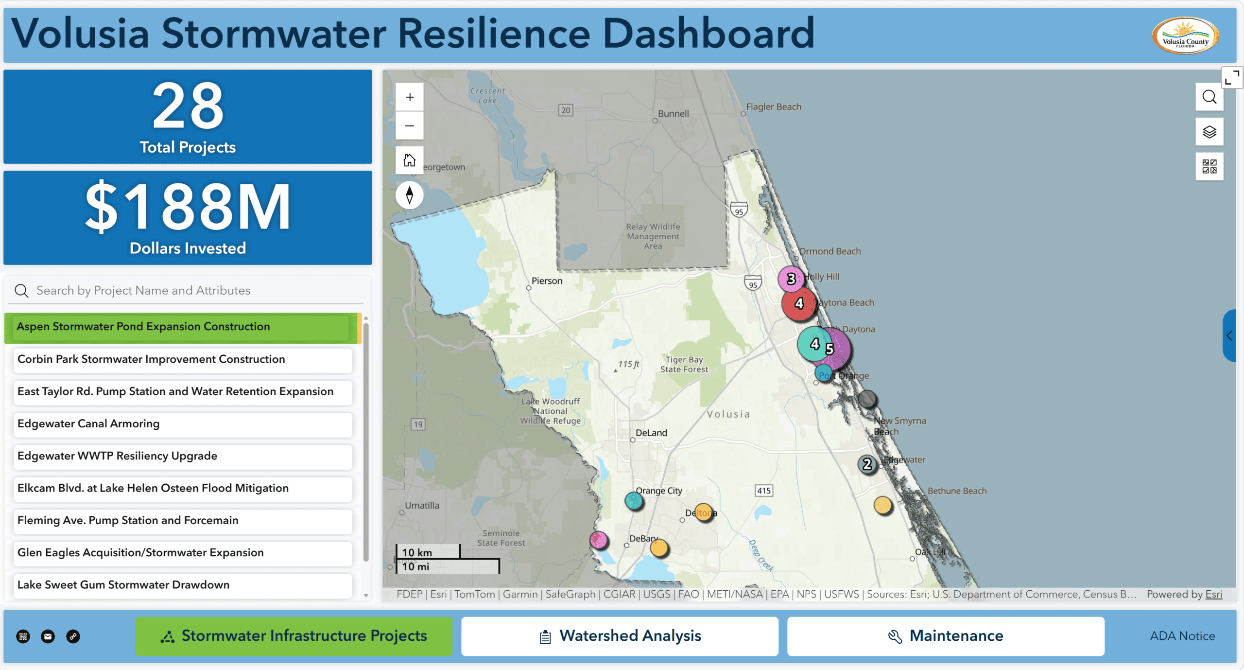
Halff’s work with Volusia County illustrates how infrastructure information can support a broader understanding of assets and future needs. More than a map, the Volusia County Stormwater Resilience Dashboard acts as an interactive project management and communication tool, bringing projects, studies and maintenance activities into one intuitive geographic experience. Halff handled the heavy lifting behind the data and continues to handle maintenance, giving the County a centralized resource that has earned overwhelmingly positive feedback.
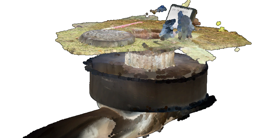
Town of Addison Storm Drain Rehabilitation
Rather than simply compiling existing records, Halff built a high-quality, basin-wide digital picture of the condition of the Town of Addison’s stormwater system. This combined field surveys, CCTV and manhole inspections, GIS review and engineering evaluation. That integrated dataset gave the Town a stronger basis for identifying problems, prioritizing maintenance and extending the life of stormwater assets throughout the White Rock Creek Drainage Basin.
City of Athens Asset Management Software Implementation
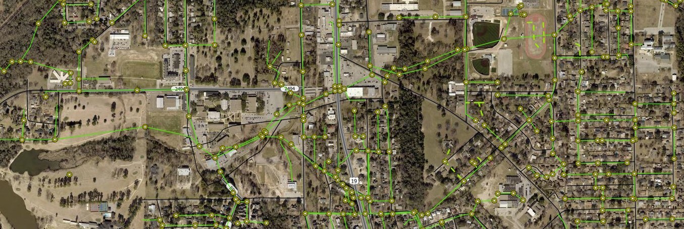
Building on the City of Athens’ early investment in GIS, Halff helped implement an enterprise asset-based work order management system across multiple departments. Halff’s team built the GIS foundation the technology needed to work, converting legacy CAD utility information into GIS, updating years of zoning changes and developing web applications that allowed City staff to view and edit current information. Halff also created mobile field tools and trained staff, turning GIS from a repository of information into a resource the City could actively use for asset and operational decisions.
City of Arlington Stormwater Technical Support
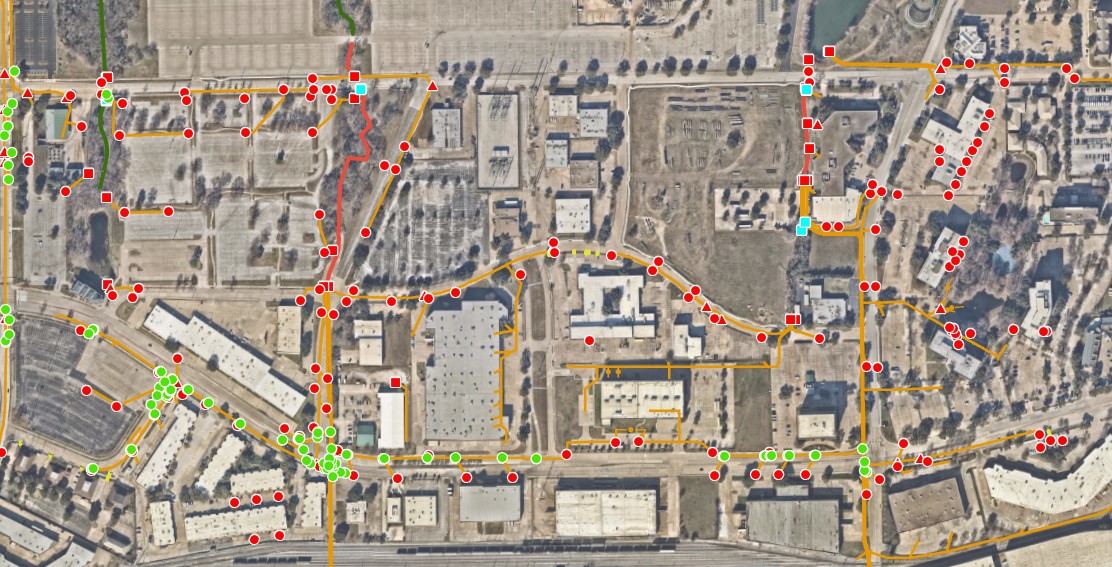
Halff is helping the City of Arlington look beyond simply updating its stormwater GIS by diagnosing why its existing information wasn’t fully supporting asset management decisions. Through staff workshops and a structured gap analysis, Halff evaluated data completeness, spatial accuracy, attribution and workflows, then developed targeted recommendations to strengthen the City’s database and data governance. The resulting work is a more defensible asset inventory designed to support condition assessment, maintenance prioritization and capital planning.
Information Translated into Infrastructure Decisions
Better infrastructure management and decision-making begins with better information.
To deliver the results our cities and communities need and rely upon for future growth, we must establish data-driven stories that help us make decisions that take into account and connect critical information with the people and decision makers who know what to do with it.
Need a Data Consultant to Partner With?
We help your projects and communities succeed through data that tells the whole story, not just pieces of it.
Contact Infrastructure Management and Data Analytics Practice Leader Elizabeth Young (eyoung@halff.com) to begin a consultation on what data and deliverables can make the most difference for your projects.

Recent Stories

Halff Announces Carpenter as Chief People Officer, Hollis as Chief Delivery Officer
RICHARDSON, Texas — Halff, an employee-owned, full-service infrastructure consulting firm, has announced Greg Carpenter, SPHR, SHRM-SCP, will join its Leadership Team…

The Block Jax Receives FPZA First Coast Outstanding Design Award
JACKSONVILLE, Fla. — The Block Jax, a mixed-use entertainment venue designed to provide outdoor recreation in North Florida and creating a…