
4,395 sq. mi.
Tampa Bay Regional Planning Council (TBRPC)
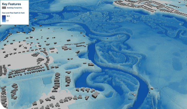
Halff partnered with the Tampa Bay Regional Planning Council (TBRPC) to develop a GIS-based framework for evaluating flood hazards across the seven-county Tampa Bay region. Funded through the Florida Department of Environmental Protection’s Resilient Florida Program, the Tampa Bay Regional Inundation Coordination (TBRIC) project established regional datasets and analytical methods aligned with Section 380.093, Florida Statutes, addressing storm surge, FEMA flood zones and sea-level rise.
Halff developed county-specific GIS datasets and configurable ArcGIS Pro tools to map flood inundation extents and depths using terrain and flood-scenario data. These tools enable local governments to evaluate flood exposure, assess potential impacts to critical infrastructure and incorporate updated data and scenarios into vulnerability assessments.
TBRIC provides a consistent technical foundation for regional flood-risk analysis, infrastructure protection and resilience investments. The project earned Esri’s 2024 Special Achievement in GIS (SAG) Award for its innovative application of GIS technology.
Halff Services
Involved
- Watershed Plans & Studies
- Geographic Information Systems
- Planning
- Resilience



Let’s Connect
Ready to work with Halff? Simply fill out the form to be directed to the best person at Halff to discuss your interests.