Unique City of Austin Tree Inventory Project Integrates Geospatial Asset Management Tool
A tree survey is a common undertaking used to gather data and help property owners, developers and municipalities make informed decisions about their trees. Meanwhile, a geospatial database can store and query valuable information about objects such as roadways, utilities or natural features and pinpoints their exact geographic locations.
Halff brought the two together in a unique project for the City of Austin’s Public Works Department.
The City set out to conduct a comprehensive inventory and analysis of trees within the public right of way. The efforts are intended to help the City better understand the urban forest and provide a framework for more proactive management of its green infrastructure assets. While identifying what trees (and their conditions) are within the City’s management purview is a primary goal, a second purpose for the project is to implement the database as a fully digital geospatial asset management tool when making management decisions about those trees.

The City of Austin has a stated goal to increase the overall tree canopy.
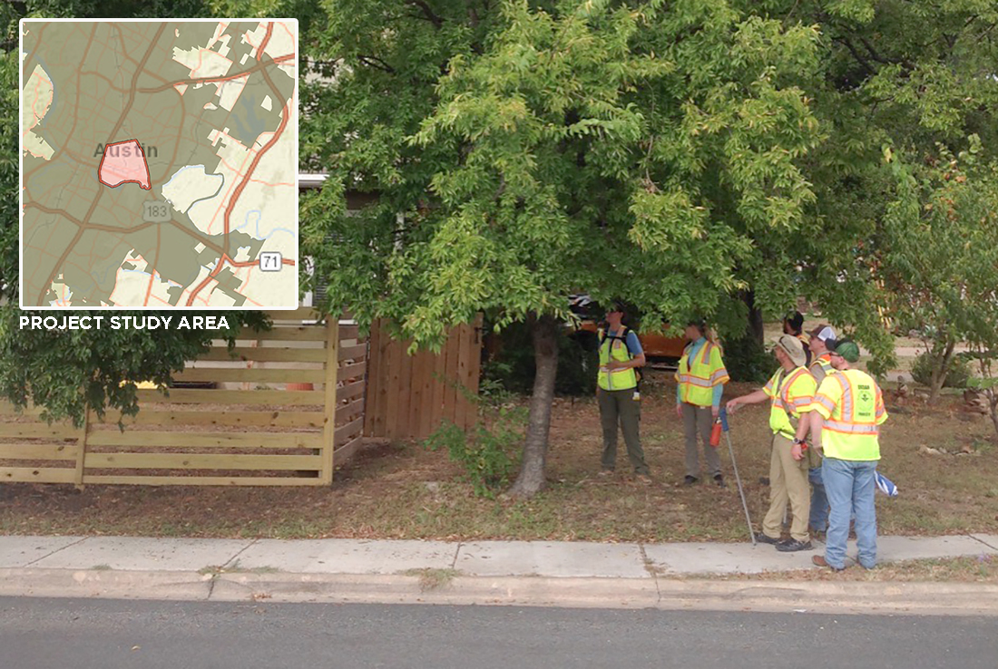
Nearly 16,000 Photos Captured in First ZIP Code
The 78702 ZIP code on the east side of I-35 in central Austin was identified as the best location to begin this pilot project because the area has undergone substantial redevelopment over the last two decades. Infrastructure improvement projects, which include significant landscaping efforts and tree plantings, have left City staff wanting to catalog those efforts so they know where plantings were successful and where they were not, as well as identify areas where further planting efforts are needed and/or appropriate.
The Halff team, working with four subconsultants, inventoried 7,604 trees in the 78702 ZIP code and has reported the pilot phase findings. The public right of way in that zone included 137 species of trees, but has dense populations of crape myrtles, sugar hackberries and pecan trees.
Two teams of two spent roughly six weeks gathering the data and taking 15,919 photographs. The project scope was to take at least two photos of each tree surveyed—one of the overall tree form and one leaf/bark photo to assist with QA/QC and identification of the species. More photos were taken in cases where specific conditional issues were found.
The inventory team was trained on proper data collection methods before the project began.
The teams encountered 149 dead trees or stumps, which is important data as well. The urban forest management plan goal is to increase the canopy within Austin. This data shows the City where there are opportunities to replace the stumps with living trees.
City staff is also interested in three potential disease or pest threats: oak wilt, emerald ash borer and Dutch elm disease. This project identifies areas where clusters of trees are susceptible to any of the threats, allowing the City to monitor and perform preventive maintenance.
Following data collection, two weeks of QA/QC were led by Halff’s certified arborists. They also assisted with data collection training before the project began.
![]()
A project tracker was developed to keep City of Austin staff informed throughout the process.
Expanded Data Used for Ecosystem Analysis
A project tracking dashboard was developed and deployed through ArcGIS Companion, allowing Halff and City staff to review inventory data in real time and evaluate statistics during the initial phase. An analysis of the vegetation structure, function and value was also performed using an ecosystem service analysis tool. Having that information, too, will promote more knowledgeable management decisions.
As inventory is updated, refined calculations can be made of value per tree, plus value for the overall right of way or forest in terms of structural dollar values, carbon sequestration, pollution removal and stormwater attenuation associated with the trees.

Halff is scoping the next phase of the project, which will include inventory of trees in four ZIP codes on the west side of I-35.
Learn more about Halff’s sustainability efforts by writing to Info-Environmental@Halff.com. Read about more environmental or GIS projects.
Recent Stories
Inside Halff: A Look at May 2026
Halff projects earned national recognition for engineering excellence, while the firm was honored for its impact on communities and the…

AML’s Convention | June 17-19, 2026
Come see Halff at AML’s 92nd Convention. Taking place June 17-19, 2026, in Little Rock, Arkansas. Event: Arkansas Municipal League,…