1.5-mile corridor
The Texas Department of Transportation (TxDOT) El Paso District
Commuters and travelers in El Paso, Texas, have seen traffic volume and congestion increase substantially along the I-10 corridor. Recent population growth and economic development have necessitated highway improvements for I-10, and future growth trends suggest these improvements will need to accommodate a significant increase in demand.
The Texas Department of Transportation (TxDOT) El Paso District selected Halff Associates, Inc. (Halff) for a 2017 Survey On-Call work authorization. One project in the work authorization, the I-10 Bridge Modeling and Construction Verification project, was a multi-phase roadway transportation project that would help address challenges for the densely populated and growing urban environment in El Paso.
TxDOT recognized constructing an interchange in one of the corridor’s busiest areas would address the lack of direct connectivity from I-10 to the adjacent community development. Operational improvements to the I-10 facility and its surrounding streets were also included as part of the larger bridge modeling and construction project. In addition to the normal logistical issues encountered in a large-scale project, addressing these project components in a busy corridor presented TxDOT and Halff with unique challenges.
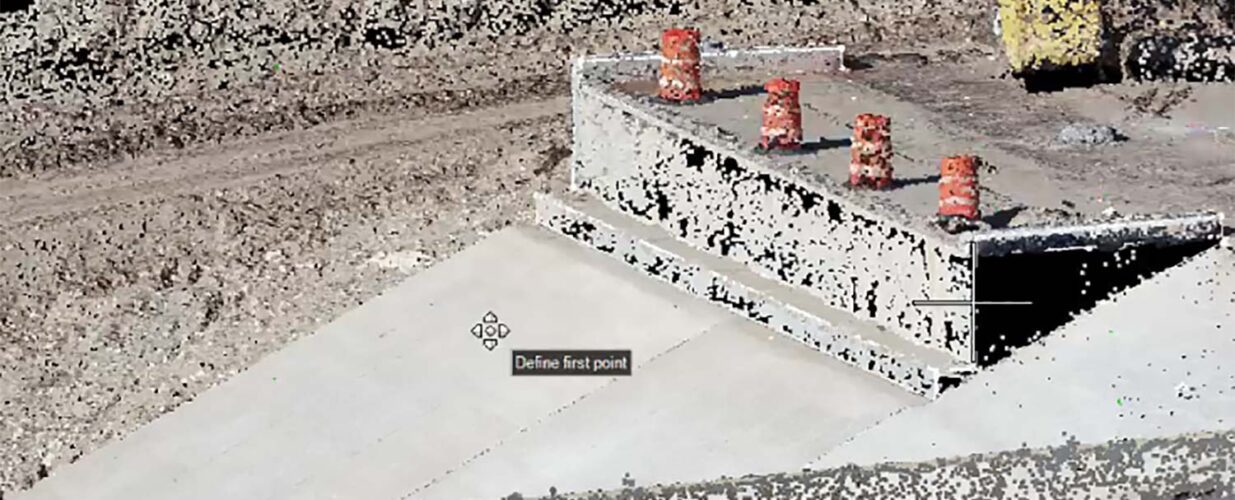
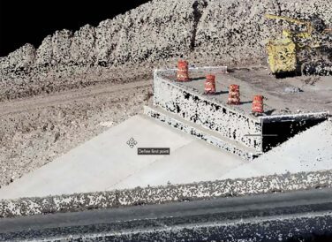
Halff collected data across three roadway sections, as well as at an interchange, to verify that its bridge columns were placed properly. Because these bridge columns had been placed several months before the road’s construction, TxDOT needed to verify these columns had not shifted after the concrete set. TxDOT would use Halff’s data to look for any abnormalities by checking the new data against data collected six months ago.
While traditional land surveying work on roadway and transportation projects have been central to Halff’s Surveying practice for more than 60 years, the firm has invested heavily in geospatial technologies over the past five years. These technologies have included: manned and unmanned aerial photogrammetry, light detection and ranging (Lidar), mobile Lidar systems, and terrestrial-based Lidar services. TxDOT wanted to use geospatial services for this project because these data collection methods are perfectly suited for highly detailed and complex projects. Geospatial technology allows surveyors to collect complete datasets using data fusion processes, and hybrid mapping processes enable more accurate, thorough and efficient data collection processes that save time and money.
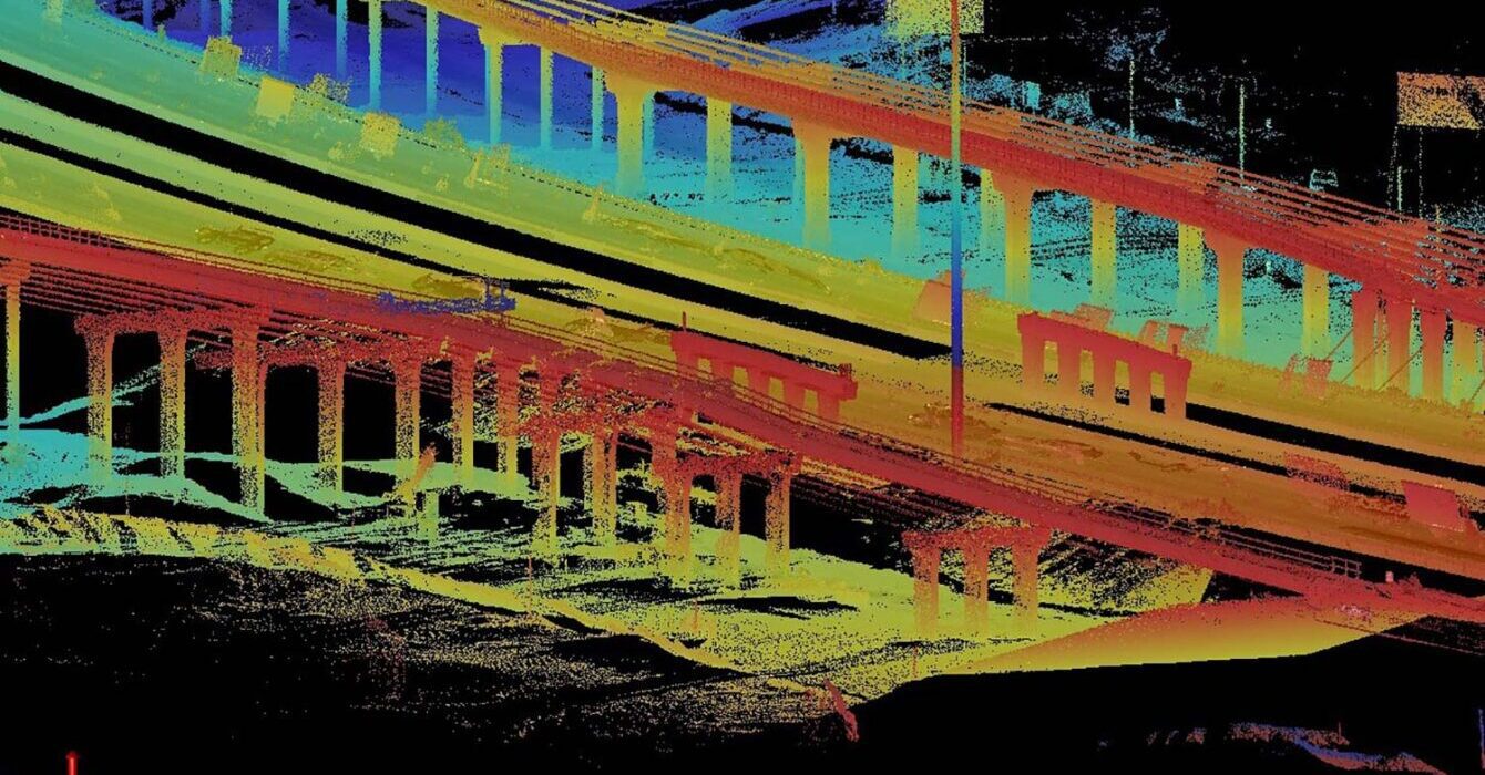
Halff’s Surveying and Geospatial team collected data throughout 16 bents and 65 columns for eastbound traffic, and another 16 bents and 66 columns for westbound traffic. The control was leveled to eliminate as many errors as possible, to meet uniquely stringent accuracy requirements. The team used two terrestrial scanners to capture as many visible structural elements from the ground as possible. The caps of the bents were not visible from the ground position, so this data was collected with Lidar and structure-from-motion techniques using Halff’s small unmanned aircraft system (sUAS) fleet. The tremendous amount of overlapping data created a complete and comprehensive point cloud dataset of the structures. This data was registered and calibrated to the leveled control.
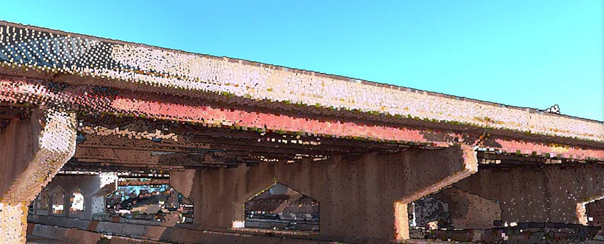
Halff’s Geospatial technicians then modeled these structures in high-definition 3D, working closely with TxDOT’s survey and design teams and other consulting engineers to analyze the structures. Several data elements, such as the degree of the lean, the twists at the bottoms and tops of columns, and parallel and perpendicular linear measurements, were recorded in spreadsheets using the 3D models. Some of the bents already had beams on them, and Halff collected data about profiles along beams, abutments that already contained beams and stand-alone abutments.
The Lidar data Halff collected was vectorized, delivering one-foot contours, full planimetric detail and orthophotography with a quarter-inch pixel resolution. All the datasets from the aerial mapping, mobile and terrestrial LiDAR, and conventional surveying collections were merged using data fusion processes, creating a complete mapping solution that showed a comprehensive view of the bridge structures.
Halff Services
Involved
- Geospatial
- Surveying
Let’s Connect
Ready to work with Halff? Simply fill out the form to be directed to the best person at Halff to discuss your interests.