2,980 sq miles
Harris County Flood Control District
Halff is working on a regional master planning effort for the San Jacinto River Basin. The study is funded through both a FEMA Hazard Mitigations Grant Program and a partnership with HCFCD, the San Jacinto River Authority, Montgomery County and the City of Houston. The study’s major objectives include:
- Identifying the basin’s vulnerability to flood hazards
- Mitigation planning aimed at structural flood reduction
- Flood warning and flood response
- Outreach and education for stakeholders in the seven-county area and the public.
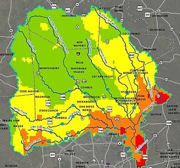
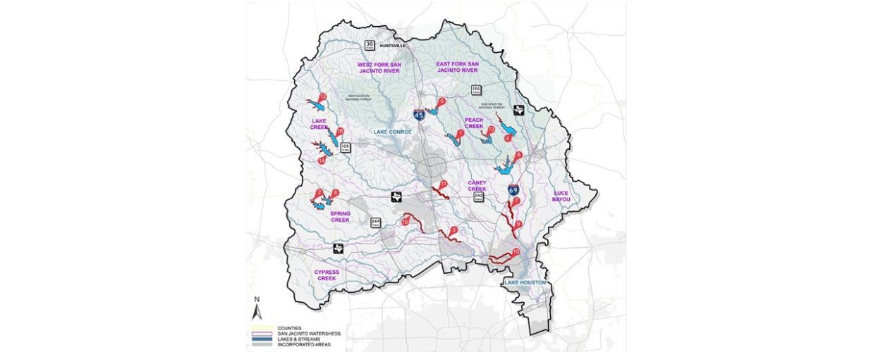
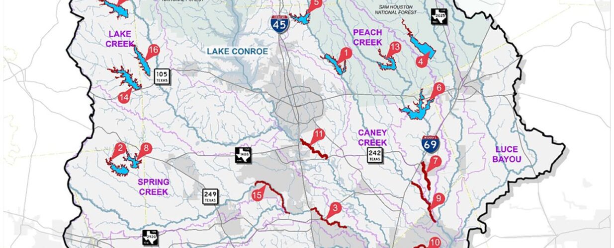
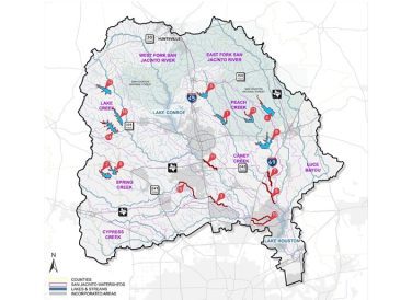
As part of the study, Halff updated or prepared H&H models of the 2,980 sm watershed with more than 535 river miles of hydraulic river modeling along major rivers and tributaries.
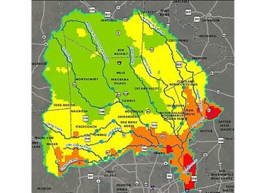
The San Jacinto Regional Watershed Master Drainage Plan included three mitigation categories: primary, secondary and other mitigation actions.
Primary mitigation planning focuses on regional structural improvements and policy changes. These are intended to physically reduce flooding and the associated risks to the communities along the major streams in the basin. Through a series of data reviews and workshops, Halff identified and evaluated nine separate major flood reductions alternatives.
Secondary mitigation planning recognizes that structural improvements are long-term and only part of the solution. This effort evaluated the current gage network and associated flood warning system, and provided recommendations for augmentation of the existing gage network. Finally, the study includes a robust public outreach effort, which includes direct coordination with all seven counties as well as the public.

Halff Services
Involved
- Environmental
- Geographic Information Systems
- Landscape Architecture
- Land Development
- Local Infrastructure
- Planning
- Right of Way
- Surveying
- Watershed Plans & Studies


Let’s Connect
Ready to work with Halff? Simply fill out the form to be directed to the best person at Halff to discuss your interests.